Paddling routes
See the paddling routes on the map (in Finnish).
Kernaalanjärvi – Tuulensuunjoki – Hyvikkälänjoki – (Haapajärvi) 9 km
Hyvikkälänjoki river flows from lake Haapajärvi towards lake Kernaalanjärvi, but the river section can also be paddled upstream. The winding river route starts from lake Kernaalanjärvi and continues to the relatively wide Tuulensuunjoki river. At the bridge of Rehakantie No. 2873, there is a short section with a stronger current that can be paddled even in summer. In high water, for example in spring, the flow can make progress challenging even for experienced paddlers. After the bridge, the river changes its name to Hyvikkälänjoki. The river mainly flows through varied agricultural landscapes. There is some summer housing along the riverbanks. However, there is only one section classified as a rapid in Hyvikkälänjoki. When approaching the rapid at the landing site by the rapids’ edge, it is advisable to watch for the rocks visible above the water surface starting from May. Depending on the water level, the rapid can also be paddled upstream, but if necessary, the canoe must be carried along the right bank of the river for about 20 meters.
Hyvikkälänjoki river is easy to paddle almost all the way. About 200 meters before the confluence of Hyvikkälänjoki river and lake Haapajärvi, there is a dam. THE DAM CANNOT BE CROSSED BY WATER OR FROM THE BANK. Note! The dam is difficult to detect from the water if approached from the direction of lake Haapajärvi. The only warning of the dam is a sign reading “dam 50m” erected on the riverbank.
Viralanjärvi – Kuotolanjärvi – Räikälänjoki – Kernaalanjärvi 9 km
The flow direction of Räikälänjoki river is from lake Viralanjärvi towards lake Kernaalanjärvi, but the route can be paddled in both directions. The beautiful route passes through small lakes to the narrow Räikälänjoki river. On the lake sections, paddling is easy along the shores in windy weather. The calm-flowing Räikälänjoki river is sheltered from the wind, making it easy to navigate in any weather. There are no rapids on the river section, so the route is also suitable for beginners. The river winds through lush scenery past Janakkala Church, and there is some holiday housing along it. Additionally, at the Räikälänjoki bridge in Janakkala Church, there is a landing site from which you can explore the area’s archaeological and historical sites. At the confluence with lake Kernaalanjärvi, the mouth of Räikälänjoki river with its wide wetlands is an important site for water and shore birds, where nesting of the northern harrier has been observed.
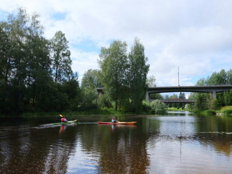
Image from Puujoki river at Leppäkoski.
Puujoki river / Jokimaa – Tanttala – Ryttylä – Leppäkoski – Kernaalanjärvi 20 km
Puujoki river is primarily a calm river flowing towards lake Kernaalanjärvi. The river can be paddled in both directions and is well-suited for recreational paddling or exercise. The only real rapid section is at Leppäkoski. The river route winds through rural landscapes, but in summer, when the water level is lower, the beautiful scenery may not be visible from the riverbed. However, there is variety along the way, such as beautiful idyllic bridges and some vacation housing. Paddlers along the banks of Puujoki river may spot migratory birds early in the spring.
Note! About a kilometer before the swimming beach of Leppäkoski, the rapid section of Puujoki river begins, which is approximately 300 meters long. Early in spring or during floods, the current is strong, but calms down as summer approaches, making the rapid easy to cross. When approaching the rapid from the Jokimaa direction, choose the right-side underpass under the bridge, where there are no large rocks.
Kesijärvi – Toivanjoki – Alasjärvi 9 km
The length of the Toivanjoki river paddling route is 8.7 km. The calmly flowing river can be paddled in both directions, but if you choose to paddle with the current, a natural starting point is the lake Kesijärvi Lepokallio boat and swimming beach. In addition to parking and restroom facilities, the swimming beach also has a picnic table.
Starting from the Lepokallio boat beach, the direction towards the power lines that Toivanjoki river flows under is easy to take. You only need to paddle along the eastern edge of lake Kesijärvi for about a quarter of an hour before reaching the river mouth, and along the way, you can admire the old brick factory milieu. The mouth of Toivanjoki river opens as a wide river and flows slowly throughout the journey.
The riverbanks are framed by high reeds, creating a paradise for bird watchers. It’s advisable to have binoculars handy, as a variety of waterfowl is guaranteed. In the spring, at the beginning of the growing season, you can see far over the reeds, and in the swamp, you can observe the cranes’ slow walking. The most bird diversity can be found at the protected Toivanjoki bird wetland, which is identifiable by the high bird tower standing at the forest edge. In 2014, additional open water areas were excavated in the swampy wetland for birds to provide sheltered nesting and feeding areas. Besides cranes, you may spot other birds such as great egrets, whimbrels, or northern harriers.
There are few resting places along Toivanjoki river. About halfway through the paddling route, there is an idyllic wooden bridge where it’s easy to pull the canoe ashore. The wide rails of the bridge provide a nice place to sit and enjoy a snack while taking in the summer day and the beautiful river scenery.
After the bird wetland, the forest edges steepen, and on the right side of the river rises the majestic rock wall, Takalankallio. Soon after, the river becomes part of lake Alajärvi’s Kuosarinlahti. After paddling for a while, Alajärvi’s wide area unfolds ahead, and on the opposite shore, you can easily spot Puuhamaa amusement park. The beautiful yellow manor building of Tervaniemi is also clearly visible from the lake, as is the nearby endpoint of the paddling route, Suruton swimming beach. Near the shore, there is a shelter where you can take a break before carrying the canoe uphill to the parking area at the swimming beach.
Difficulty: The estimated paddling time for the route is about 2 hours and it is rated as easy.
Kernaalanjärvi – Hiidenjoki – Miemalanselkä 15 km
Hiidenjoki river flows calmly from lake Kernaalanjärvi to lake Miemalanselkä towards Hämeenlinna. Paddling on Hiidenjoki river is suitable for beginners or those paddling for exercise since there are no rapids on the route. At the upper end of Hiidenjoki near Turenki, there are houses and cottages along the riverbanks; otherwise, the route winds through nature in a wilderness-like swamp area. Landing at locations other than designated landing sites is difficult as the riverbanks are covered with abundant vegetation and are partly swampy. Note! On the segment of Hiidenjoki river between Hämeenlinna and Leppäkoski, there is an official water route, so paddlers are advised to paddle close to the shores.