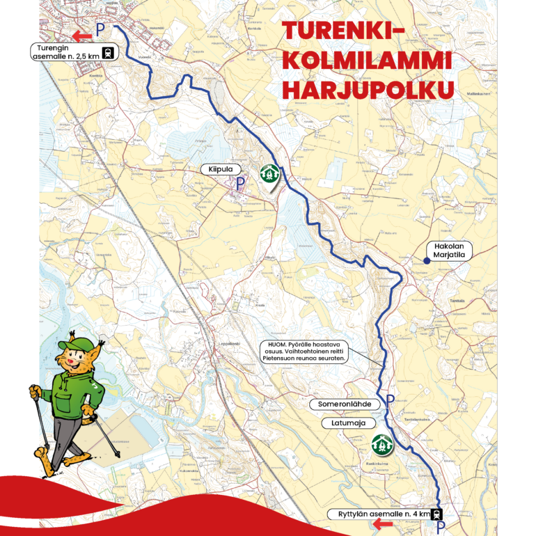
Turenki-Kolmilammi Esker trail
Hausjärventie
The long longitudinal esker from Hausjärvi through Janakkala to Hämeenlinna was formed after the Ice Age when melting ice streams separated different types of soil materials from each other. Coarser soils formed ridges, the soil materials of which allow rain and melting water to be absorbed into groundwater.
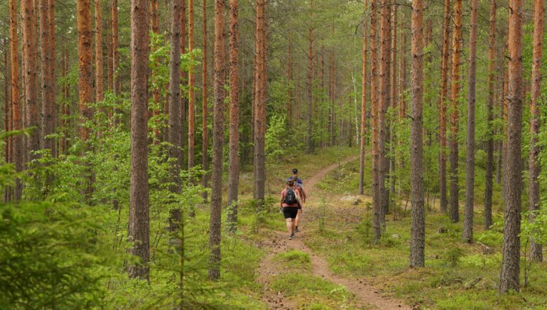
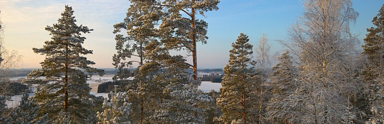
The paths that crisscross the top and area of the esker are among the most impressive places in Janakkala for outdoor activities and hiking long distances. From Turenki, you can hike or bike continuously along the esker to Hausjärvi’s Kolmilammi, covering a distance of about 15 km. The trail offers beautiful spots from the top of the ridges, where you can admire the Häme rural landscape far above the treetops. The ridge terrain is mainly pine forest, but at times the path dives down even into swamp-like terrain.
The esker trail that runs north of Somero is challenging for cyclists, but the section can be bypassed by following an alternative route along the road that runs along the edge of Pietensuo mire.
You can take a snack break at the Janakkalan Latu cabin located near Someronlähde spring, where hikers have access to a lean-to and a dry toilet. Along the trail, there is also versatile Kiipula, where you can take a break at Miinantori or even stay overnight. Hakola berry farm with its cafes is also a short detour from the trail.
You can swim at the beginning and end of the route, at Ahilammi or Liinalammi in Turenki, as well as at Kolmilammi in Hausjärvi.
The esker trail is not marked in the terrain, but the route is relatively easy to follow by staying on top of the esker and following a map. The route is described in Janakkala’s map service.
Please walk carefully and respect nature by staying on visible paths. The trail mainly passes through private lands, and the landowners have given permission for the publication of route information.
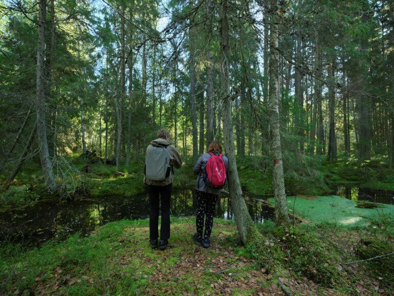
The ridges are also the secret of Janakkala’s high-quality drinking water. The finest open spring in the ridge area is Someronlähde spring, which is located along the esker trail. The spring is formed when groundwater moving underground meets the earth’s surface and emerges as surface water. The spring has its own unique ecosystem that thrives year-round in cold water and shade.
Parking: In Turenki at Hakamäki sports field’s parking area (Tykkivajantie), in Kiipula at large parking areas (Kiipulantie 507), as well as at the parking area of Kolmilammi dance hall (Kolmilammintie 267). Along the way, there are spots along the forest roads that branch off Hausjärventie where individual cars can be parked. For example, the Janakkalan Ladtu cabin’s spur (Hausjärventie 1162)